April 25, 2011

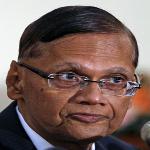
Photo: Reuters
Sri Lanka's Minister of External Affairs, Gamini Lakshman Peiris, reacts as he speaks to reporters during a media conference in response to a United Nations report released to the Sri Lankan government, Apr 21, 2011
A U.N. panel of experts is expected to release a report soon citing evidence of war crimes in the final months of Sri Lanka's civil war. Among the evidence the panel reviewed was satellite imagery from the final days of the conflict.
In May of 2009, when the Sri Lankan army had insurgent Tamil Tiger forces flanked in the country's Northeast, analyst Lars Bromley pored over two sets of satellite imagery for the American Association for the Advancement of Science. Human Rights Watch and Amnesty International had turned to AAAS because they were concerned about the safety of civilians.
Two sets of images were captured - one at the start of a heavy battle on May 6, and one when fighting abated on May 10. Bromley says visible shell craters offered possible evidence Sri Lanka was firing into an area it had designated as a civilian safety zone.
"We were basically able to basically locate multiple mortar locations that corresponded with the locations of the craters and the pattern of the ejecta [material ejected] from the craters. They were Sri Lankan Army positions," he said.
Bromley says there was more disturbing visual evidence. "There were definitely significant expansions between May 6 and May 10 that were going on in the number of graves," he recalled.
Makeshift camps of people displaced by the Sri Lankan civil war were also gone from the second image. Bromley said it appeared the camps were being hastily dismantled by people in fear of their lives. "With all the other information that we were piecing together at the time, that was a pretty good call to make - that they were fleeing, and that it was a chaotic situation going on," Bromley said.
Satellites have increasingly been used to monitor suspected human-rights abuses in recent years, but cost still is an obstacle: a single high-resolution image can cost as much as $10,000.
Bromley says the potency of satellite imagery increases when it meshes with other technologies. Mobile phone and web-based "crowdsourcing" platforms like Ushahidi (www.ushahidi.com) make it possible to create a dynamic and interactive crisis map to help flesh out the information in a satellite snapshot.
"The magic happens when you start pulling all these things together and you use them as an array of tools to understand what's going on. The more you understand what's going on, the more likely you are to influence the policy decisions," Bromley explained.
Still, satellite images seldom convey the legal or moral nuances of a conflict. In the case of Sri Lanka, for example, the U.N. experts' report accuses Tamil Tiger rebels of taking refuge in designated safe zones - effectively using the civilians there as human shields, and shooting them if they attempted to escape.
Bromley says it is also difficult for satellites to capture the moves of a guerrilla force like the Tamil Tigers. "They would just kind of run out with a mortar tube and fire a few shots," he said. "And run back into a shelter. That kind of stuff doesn't appear on a satellite image at all."
As a result, a single image may at times give a misleading view of what has happened on the ground.
"You're not able to equally document the actions of both sides," Bromley stated. "You're able to document the sort of 'Earth-moving' things that one side is doing, but you're not able to document the 'shoot and scoot' sort of stuff the other side is doing."
There are also serious ethical concerns related to making satellite images available to the public.
"If you're releasing that sort of information in real time, in an environment where people are getting killed, you've got to consider how that information is being used," he said. "It's not all being used for altruistic purposes. There are bad people that will have access to that sort of information as well."
Bromley now analyzes satellite images for UNOSAT, a United Nations program that assists humanitarian groups. He says UNOSAT is not publicizing everything it sees in images of Libya, to avoid giving a tactical advantage to either side in that country's civil strife.